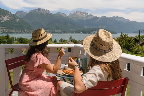
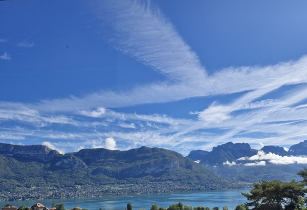
Cirque du Fer-à-Cheval (hiking)
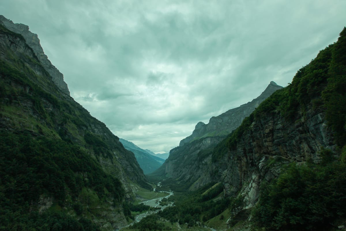
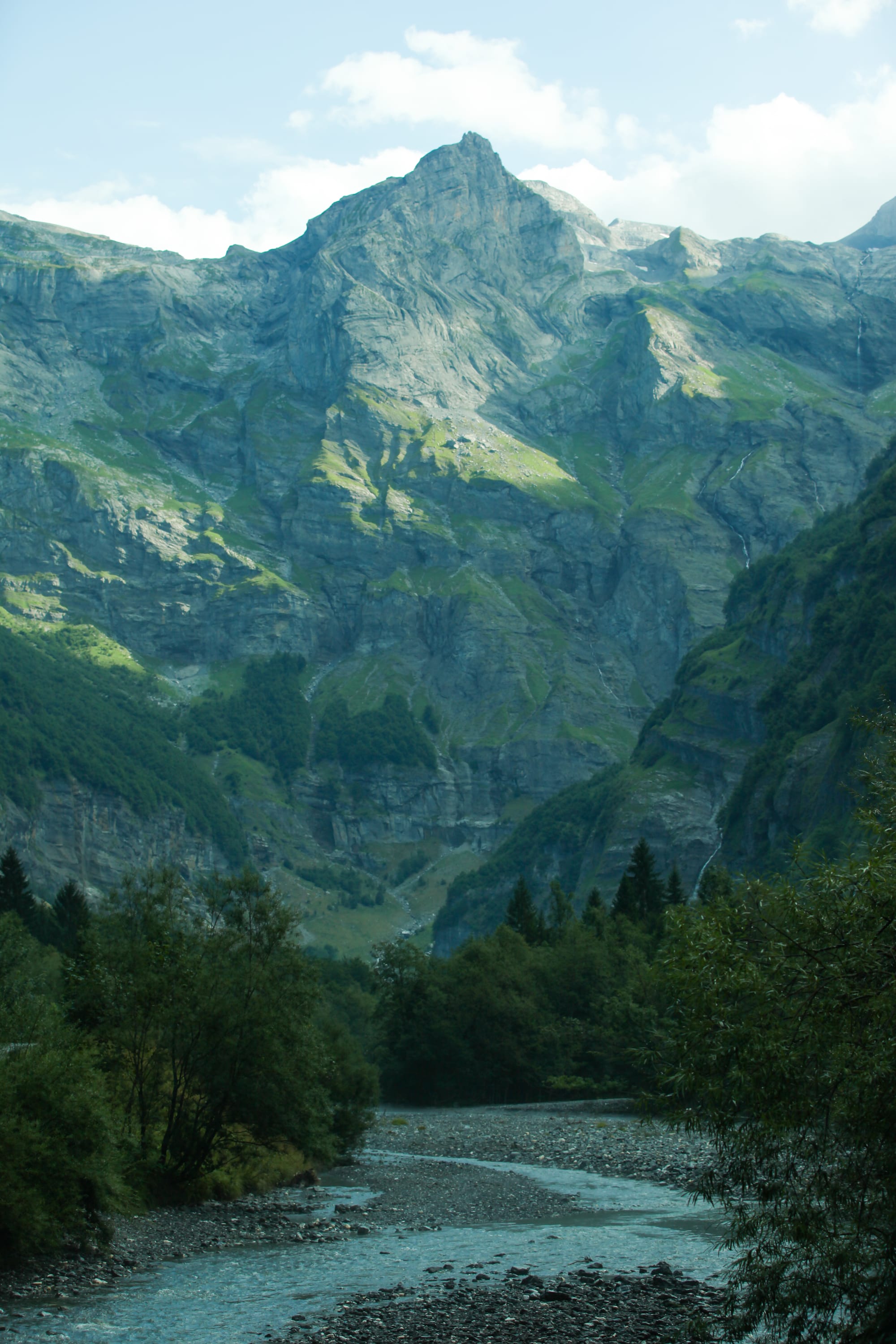
The Cirque du Fer-à-Cheval is the largest cirque in the Alps - featuring an array of imposing cliff faces hundreds of meters high, over 30 waterfalls careening from the surrounding mountains, and snowy, 2000+ meter tall peaks towering over you. It’s an impressive and beautiful sight, well worth a detour or day trip during your stay in the Alps. Featuring a variety of hiking routes in and around the valley, it has everything from short promenades along the river all the way to multi-day hikes along the Tour des Dents Blanches.
Access
The Cirque du Fer-à-Cheval is easily accessible by car. The A40 autoroute will take you all the way to Cluses, from where you can take go north and join the D907 road east, which will take you all the way to the starting point of this beautiful mountain playground. Right past the town of Sixt-Fer-à-Cheval, you will have the ability to park for free just before the toll booths, but if you want to spare yourself the 2 kilometer walk along the road to the trailhead, you can pay (as of time of writing) 7€ to park right by the start of the trail.
The Cirque is also accessible via public transport, although the bus is very infrequent - the La Région Y94 bus travels from Cluses to the end stop at Cirque Fer à Cheval only 4 times a day (and otherwise stops earlier at the bus station in Sixt-Fer-à-Cheval). The last ride home from the Cirque is at 15:10, so you’ll have to plan your trip well!
Hike to the end of the world…
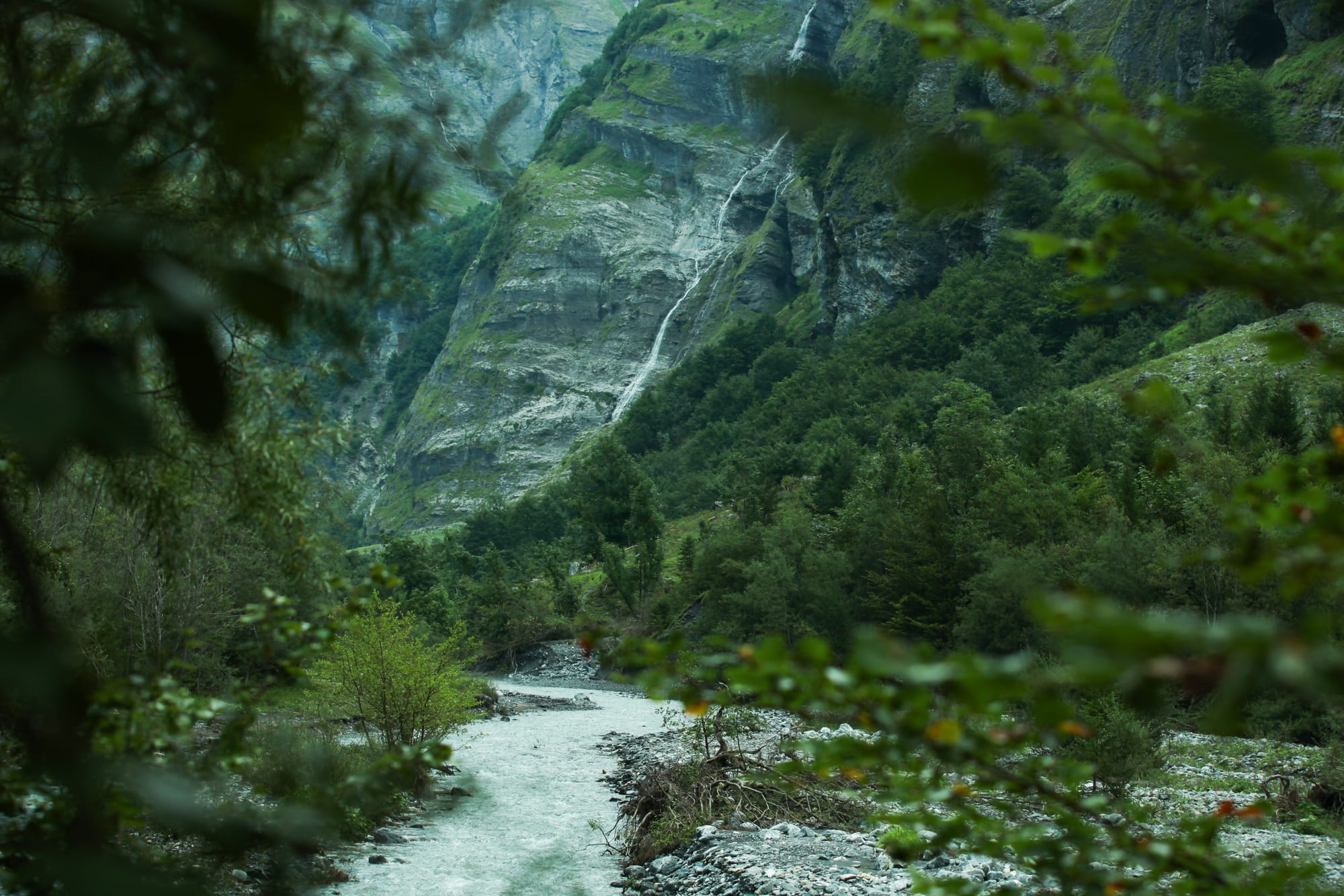
The most popular hike at the Cirque is the so-called hike to the end of the world… Also known as the “Balade au bout du monde”. This hike will take you through the valley along the Le Giffre river, with ample opportunity to observe the surrounding peaks and waterfalls. The final destination for this route is the waterfall at the aforementioned “Bout du monde” - where you will have the chance to take a break while admiring the beautiful sights from the end of the valley.
The hike begins at the Chalet du Cirque du Fer-à-Cheval - which features a restaurant (do note the opening hours, particularly out of season). You will hike north along the main path. The majority of the route is quite flat, and for the first half is a maintained gravel road. Further down, the path becomes a narrower, rocky trail, but is for the most part very easily navigable.
You will have a choice of walking along either bank of the river - both paths offer spectacular views of their own, and converge at the end, but we recommend following the right bank (particularly if you won’t be returning through the valley), as it will allow you to stop by the foot of the Vogealle waterfall. This is a stop worth making, particularly during spring, when the waterfall is at its strongest, and is a very short detour off the main route.
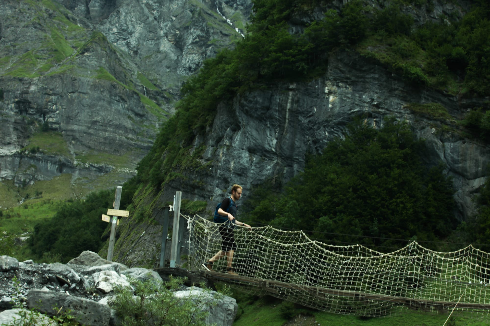
As you approach the Bout du monde, you will once again have to cross the river - this can either be done by the wire bridge at the Fond de la Combe, or, a few hundred meters along, you can ford the stream, which at this point is far shallower and safer to cross. Do be mindful of any warning signs or closed paths - rockfalls are very common in this area and can pose a danger to hikers.
To reach the end of the valley, you will then have to do a final climb of roughly 200 meters in elevation. It is moderately steep, but is well worth the reward at the end - you will arrive at the waterfall at Le Bout du Monde. The waterfall features a small cave behind it, where you can take a break and observe beautiful sights of the valley behind you.
At this point, you can return down the path you came through the valley (or via the other side of the bank). Such a round trip is 9.6km in length, and would take an experienced hiker roughly 3 hours to complete. In total the total elevation difference is 331 meters, and in general the hike isn’t particularly difficult. Thanks to the relatively flat terrain and easy path along the valley, this hike is suitable for most people, and is certainly one to not miss...
Pas du Boret… and more…
For the more adventurous, this hike can be turned into a circular route by hiking up past the Bout du Monde and up to the Pas du Boret. This route takes you above the valley on the western side, and offers even more spectacular views than from down below. It is important to note that this path is very rocky, narrow, and follows along the tops of cliff faces. You will also have to ford multiple streams, which can be difficult during spring. This hike is only for experienced hikers. Good footwear is a must, and it should not be attempted during bad weather due to slippery rocks.
This hike is very steep both during the ascent at the start, and the descent down back to the trailhead. The ascent is thankfully somewhat short, as it is only approximately 100 meters up the mountain, from where you will roughly follow the contour along the valley. Afterwards, however, you will reach a small plateau where you will be greeted by the Chalet du Boret - a great stop to reward yourself with a snack or something to drink prior to your descent. Do note that it is open only seasonally and has limited opening hours.
Afterwards, you will descend down past Le Crête de la Rosta - this is a steep and challenging descent, with multiple sections that may require you to scramble with your hands or hold on to the permanent lifelines bolted in the rock. The path will take you down to the Chalet de Prazon, which is then only a short walk back to the trailhead and parking area.
The trail from Bout du Monde back to the parking area at the trailhead is 5.5km long, with an ascent of only 160m, but with a steep and demanding 494m descent. This variant of the return trip will take about 2 hours for hikers experienced enough to undertake it.
For serious thru-hikers who are looking for a multi-day challenge with the chance to bivouac at a refuge, it is also useful to know that taking the path up along the Pas du Boret offers you a path up to the Refuge de la Vogealle. From there you can take multiple trails back to Samoëns - or you can join the Tour des Dents Blanches - a beautiful and challenging T4 circular route along the surrounding mountain peaks that crosses into Switzerland.