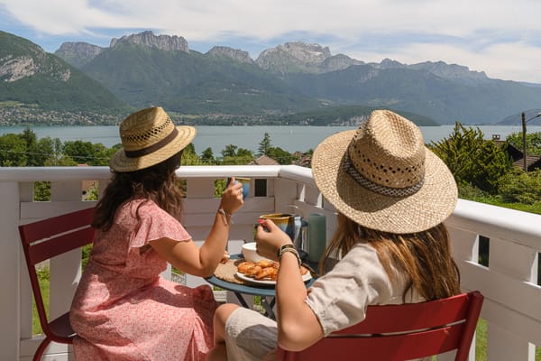
Mont Veyrier & Mont Baron (hiking)
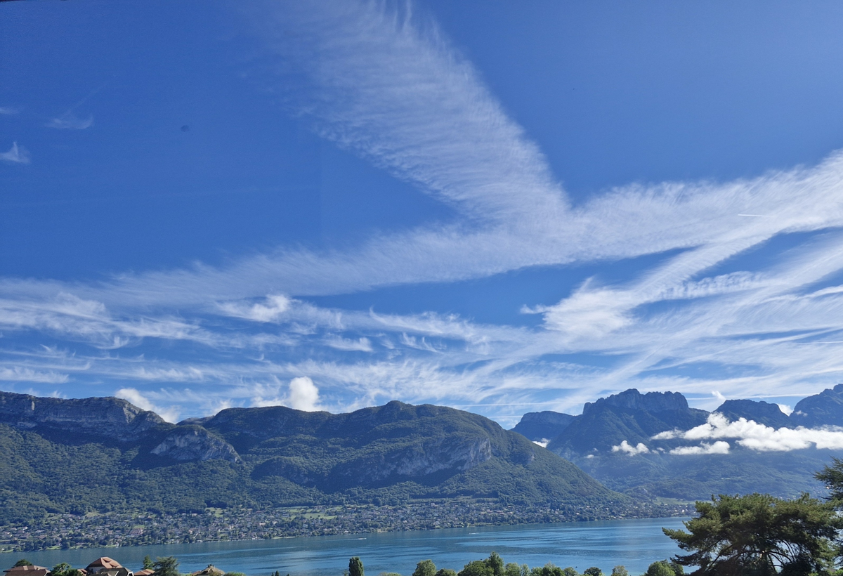
Mont Baron, overshadowing lake Annecy, is perhaps the most popular spot for a day hike from within the city. It offers a variety of environments, steep inclines, long ridgelines, and some of the most spectacular views overlooking the city and lake. On any given day you’ll encounter countless hikers and trail-runners, clearly indicative of the popularity of the trails criss-crossing this mountain towering over the lake.
There are multiple possible trails one can undertake, varying in difficulty from a light walk along the ridgeline, to half-day trips from Annecy all the way to the Château de Menthon-Saint-Bernard.
Pré Vernet to Mont Baron Loop
The first hike is a simple round trip that is perfect if you want a shorter trip with a trailhead that is reachable by car. It begins at the parking lot at Pré Vernet, and will take you up past Mont Veyrier and Mont Baron, looping back to the start with a gentle descent on the eastern side of the mountain.
The parking lot is accessible by paved road - Route Forestière du Mont Baron. This road begins on the northern end of the mountain in Annecy-le-Vieux, and will take you up roughly two thirds of the way up the mountain, where the hike will begin. The road is paved the entire way, although towards the top it can become quite narrow and full of potholes, so caution is advised if traveling with a larger car. At the end, you will find a small parking area, which has a tendency to fill up quickly on popular days - which, along with the spectacular morning views, is a good incentive to wake up early for this trip.
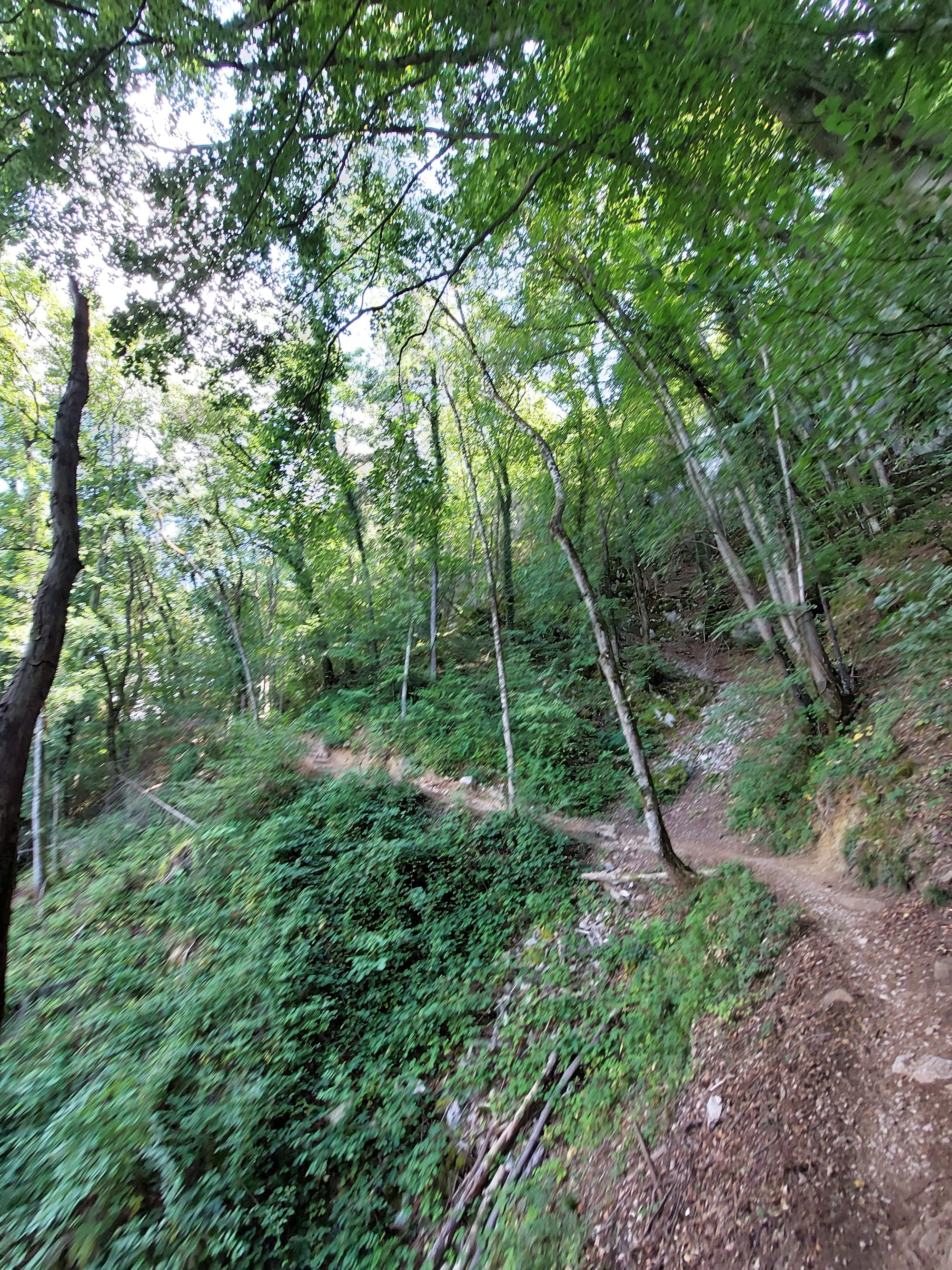
The first section of the trail is by far the most physically challenging, as it will take you up a somewhat steep, rocky incline through the forest up to the panorama at the Col des Sauts. It’s an ascent of 236 meters that will take an experienced hiker roughly half an hour. The trail is marked with green and yellow arrows on signs, as well as french tricolors painted on rocks. It’s advised to keep a good eye on the markings, as at some points the exact path ahead might not be entirely clear to those unfamiliar with the area.
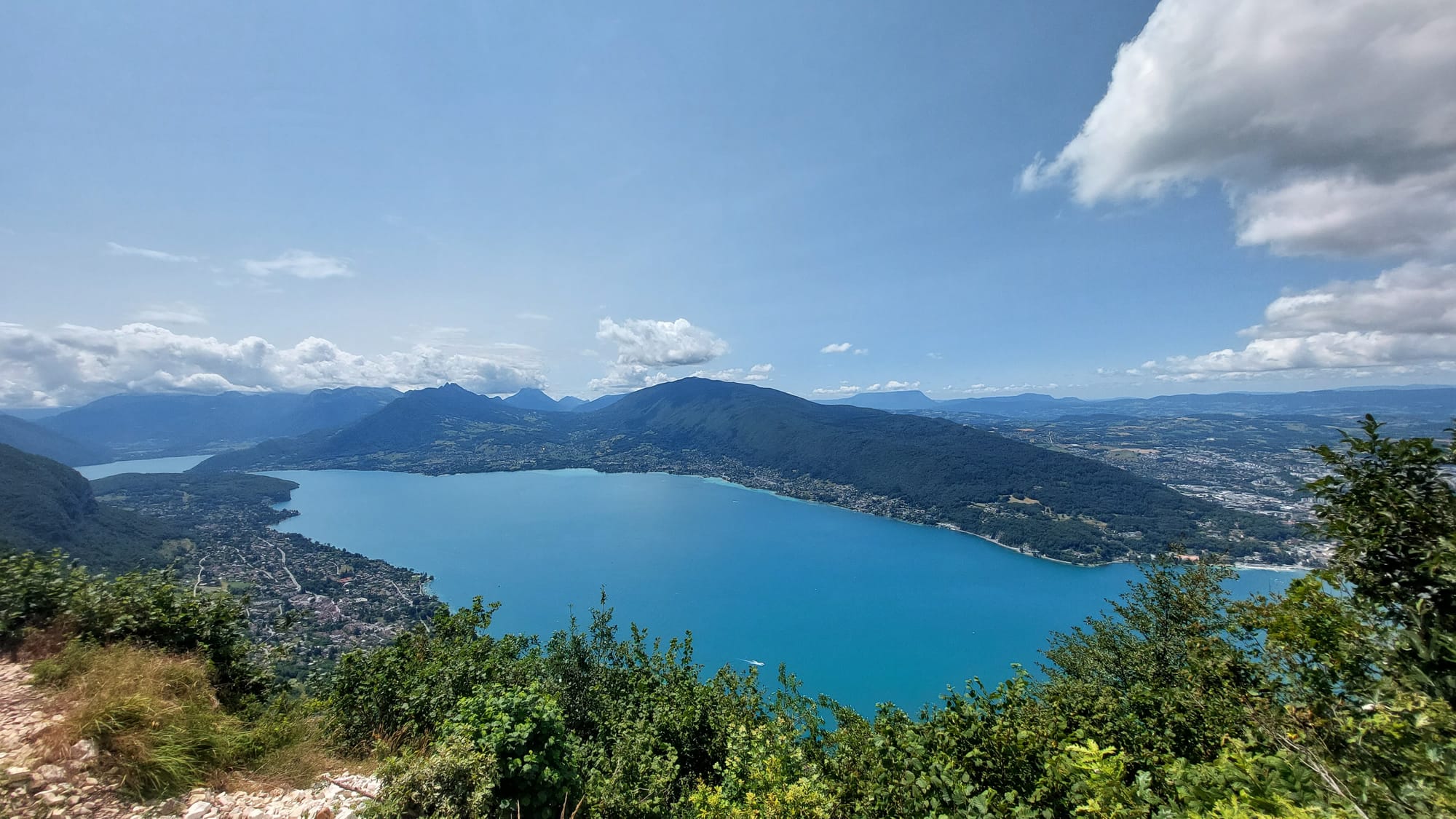
Upon reaching the Col des Sauts, you can take a well-deserved break from the initial climb while you enjoy the first of many spectacular panoramas of the lake and city below.
After this point, after another short 50 meter incline, the trail proceeds along the ridgeline, and for the most part is devoid of any significant elevation changes. At first, you will continue to pass through the forest atop the mountain, with multiple clearings giving you further views down towards the lake, before reaching Mont Veyrier, the first of the two peaks on this mountain.
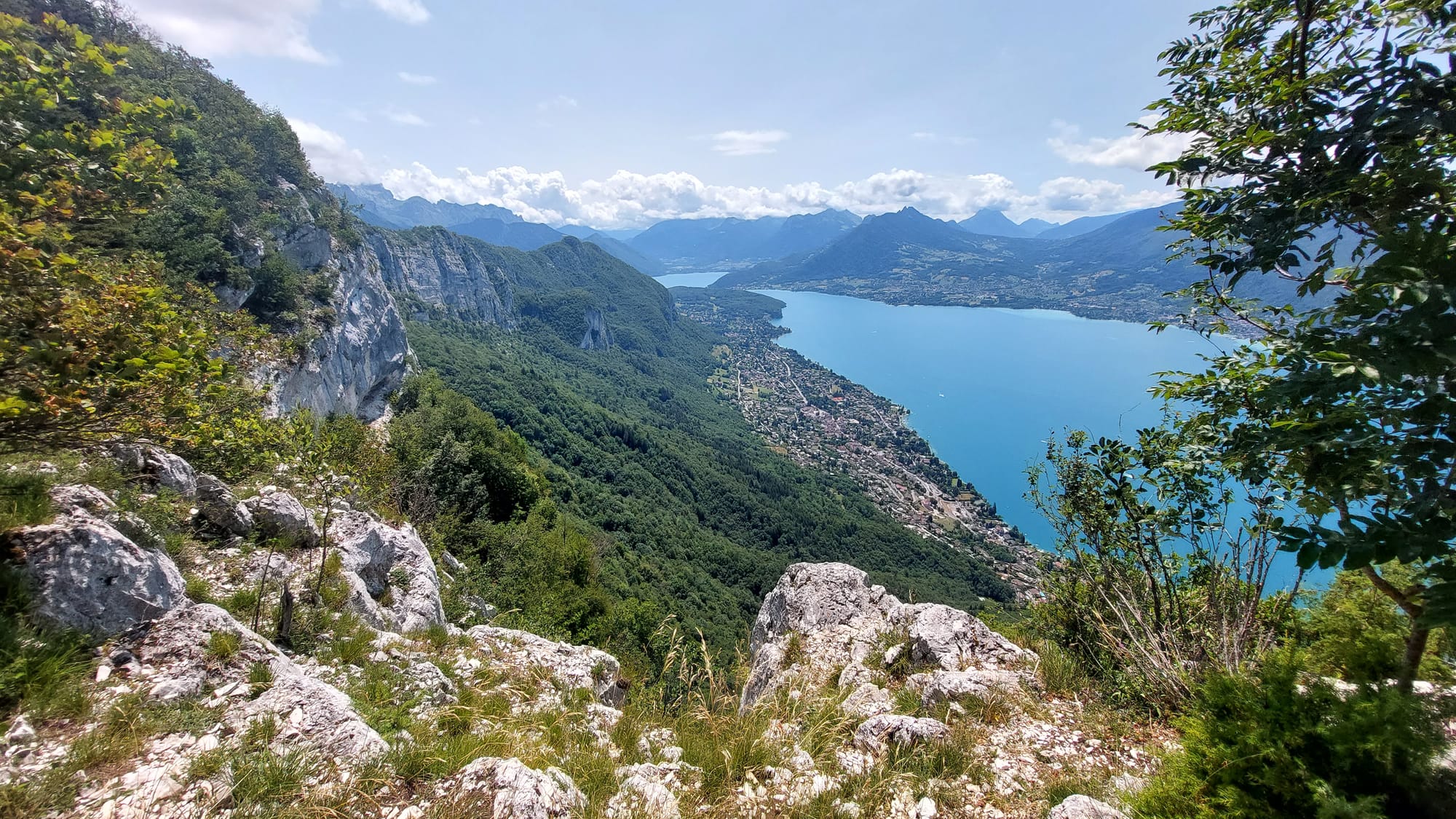
Further on, you will continue to what may perhaps be the most memorable section of this hike, as you enter a clearing and walk on top of the cliffside above the town of Veyrier. The path is narrow at points here, and lacks any guardrails, so it may be uncomfortable for those with a severe fear of heights. That being said, if you proceed with caution and a steady footing, it is entirely safe, and will provide you with an unparalleled 180 degree view of the lake.
Continuing onwards, you will reach the highest point on this hike, as you pass Mont Baron. At this point, you can turn north and walk along the plateau of the mountain to begin the descent back to Pré Vernet. The descent is fairly easy, with only a few, short steeper sections that might pose a bit of a challenge. You will pass the signposts for Plateau du Mont Baron and Creux du loup on your way before connecting up to an unpaved forestry road that will take you all the way back to the parking at Pré Vernet.
Alternatively, for those wishing to also catch some views of the mountains to the east, including of Mont Blanc and the impressive Tête à Turpin to the east, you can continue further along to the Ancienne Gare de Téléphérique at the end of the ridge. The hike there is relatively easy and along a very mild descent. However, do be cautious of the slippery rocks, particularly during dusty dry summers or wet periods.
From there, to return to the parking lot, you can take the service road down back to Route Forestière du Mont Baron and Pré Vernet.
The whole round trip will take roughly 3 hours for an intermediate or experienced hiker, with an ascent (and descent) of 437 meters. This route is suitable for most hikers, although it might be best to avoid bringing very small children or pets with you given some of the steeper inclines and unprotected sections along the cliff edge.
Extending the hike to the Ancienne Gare de Téléphérique will increase the distance by x meters, but will only add roughly 50 meters of elevation difference, increasing the total trip time by only half an hour.
Day Hike from Annecy-le-Vieux to Château de Menthon-Saint-Bernard
For those wishing for a longer, half-day thru-hike, you can modify the above route to begin by the lakeside in Annecy-le-Vieux, near the petit port of Annecy. It has the advantage of not requiring a car to access the trailhead, although there of course are multiple (paid) car parks in the vicinity. It’s worth noting the parking at the petit port is one of the few parking lots in Annecy that does not have a height limit for entry, although parking for RV’s and caravans is still forbidden between April 1st and October 31st.
To access the trailhead via public transport, you will want to stop at the Petit Port Chavoires stop, served by the Sibra bus lines 13, 20 and 26. There is also the nearby Vélonecy stop “Petit Port” for those wishing to use shared bikes to get to the trail.
This route will primarily follow along the GRP route “Tour du Lac d'Annecy”. The trail begins at the marker “le Bois Jettaz”, near the end of the pontons of the petit port. You will follow a small rocky alley up to the woods, where the climb will begin.
The climb consists of a steep, winding trail in the forest, and is a total ascent of roughly 500 meters up to the parking at Pré Vernet, and a total of 720 meters all the way up to the start of the ridgeline at Col des Sauts. Experienced hikers can climb this 4 kilometer ascent in roughly an hour, although that will depend on fitness levels.
Upon reaching Col des Sauts, you will follow the ridgeline as described earlier, all the way to the Ancienne Gare de Téléphérique. There, you will have to follow a steep descent down to the Col des Contrebandiers. This descent is quite rocky, and although short and not very physically demanding, it contains rather slippery rocks and is very steep, so using the emplaced wire handrails is recommended.
From there, you will shortly follow the road north down the hill on the Route Forestière du Mont Baron for 500 meters, before turning right onto a trail that will take you around the mountain of Mont Baret and down to Bluffy.
This trail begins with a very short steep climb of 90 meters before beginning the long, 3.7 kilometer descent down into the valley. The path is very mild and easy-going, and despite the 430 meter descent, you will find yourself approaching the village of Bluffy in no time.
If you wish to end the hike here, you can hop on the La Region bus Y62 at the bus stop on the main road, which will take you back to the Petit Port Chavoires stop. This bus however runs very infrequently - once an hour in the afternoons during workdays, and on weekends only three times in the afternoon. Make sure to consult the schedule and plan accordingly if you wish to take this bus.
Alternatively, you can walk down to the beautiful Château de Menthon-Saint-Bernard, and then afterwards into the town of Menthon-Saint-Bernard proper, before taking the much more frequent service from there back to Annecy, which will add another hour to the hike, not counting any time spent visiting the castle.
To take this path, cross the road from the bus stop in Bluffy, and follow the Route du Col de Bluffy all the way to the parking lot of the castle. Unfortunately, despite this even being a marked part of the GRP trail, there is no sidewalk, meaning that you will have to walk on the side of a fairly busy road for approximately 500 meters.
From the parking lot you will easily reach the castle. Entrance is paid, but we highly recommend at least paying for a ticket to the gardens, which as of the time of writing costs only 3€. You can also treat yourself to some beverages and snacks at a small stand in the courtyard.
To then walk down to the bus stop in the center, you can walk through a small alleyway to the left of the entrance, which will take you around the castle and down to the vineyards, which feature a path down to the town center. Please take note that the vineyards are private property, so take heed of the signs on the gates as you enter, and stay only on the path.
You can then walk along the road to the “Menthon - Chef Lieu” bus stop, where you can take the Sibra line 20 back to the Petit Port, which runs roughly every half hour.
This hike is far longer, and will take roughly 5 hours for the 11.5 kilometers down to Col de Bluffy. It features 996 meters of ascent and 815 meters of descent. Due to the length and some difficult sections, it’s recommended for intermediate and experienced hikers with decent physical condition. If you wish to go all the way down to Menthon-Saint-Bernard, it will add another 3 kilometers and 100 meters of descent, totaling 6.5 hours of hiking time for an experienced hiker.
All in all, Mont Veyrier and Mont Bernard are an iconic mountain duo towering above the lake, offering amazing and unique hikes for hikers of all levels. Let us know down in the comments of your own experiences of this hike. How difficult did you find it? Did you try an alternative route? Did you try this as a trail run? There’s loads on offer in this amazing area, let us know how you enjoyed it.